Newquay Avenue, 1955
Introduction
The photograph on this page of Newquay Avenue, 1955 by Sutton family album as part of the Geograph project.
The Geograph project started in 2005 with the aim of publishing, organising and preserving representative images for every square kilometre of Great Britain, Ireland and the Isle of Man.

There are currently over 7.5m images from over 14,400 individuals and you can help contribute to the project by visiting https://www.geograph.org.uk
Newquay Avenue, 1955
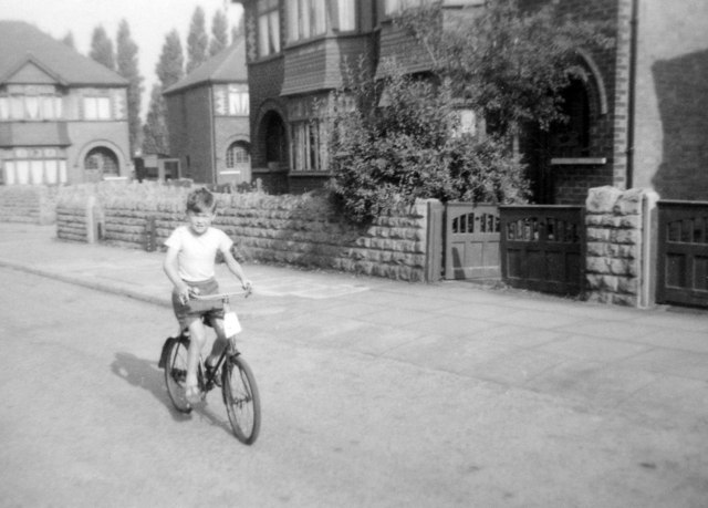
Image: © Sutton family album Taken: Unknown
For a view of the street where I lived as a child taken 55 years after this one, see Image Much is the same (the houses themselves, and their Bulwell stone garden walls), but much has changed. The wooden gates, windows and front doors (all various species of mid green in the mid fifties) have all been replaced, and thanks to the Clean Air Act, the end of steam on the nearby railway and the closure of Radford Colliery (which was behind the poplar trees visible between and above the houses on Lynmouth Crescent) the pebble-dash on the upper storeys now stays bright white and not the smoky grey it was then. The lad on the bike is me, proudly riding my first (second-hand) two-wheeled bike past our house (offstage left). Mum’s writing on the back of the tiny Brownie print dates it July 1955 and notes that I am six – so it’s before my birthday at the end of the month. The bike was maroon – but only I can see this black-and-white snap in colour....
Images are licensed for reuse under creativecommons.org/licenses/by-sa/2.0
Image Location
Latitude
52.964356
Longitude
-1.1817