Lenham Heath
Introduction
The photograph on this page of Lenham Heath by Penny Mayes as part of the Geograph project.
The Geograph project started in 2005 with the aim of publishing, organising and preserving representative images for every square kilometre of Great Britain, Ireland and the Isle of Man.

There are currently over 7.5m images from over 14,400 individuals and you can help contribute to the project by visiting https://www.geograph.org.uk
Lenham Heath
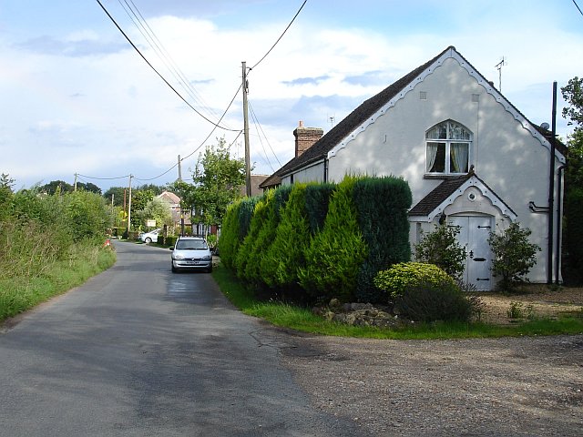
Image: © Penny Mayes Taken: 29 Aug 2006
The building on the right looks like a converted Methodist Chapel although it is still marked as a place of worship on the current map. Looking east along Lenham Heath Road.
Images are licensed for reuse under creativecommons.org/licenses/by-sa/2.0
Image Location
Latitude
51.214384
Longitude
0.740518