A61 - Hergill Lane junction
Introduction
The photograph on this page of A61 - Hergill Lane junction by Gordon Hatton as part of the Geograph project.
The Geograph project started in 2005 with the aim of publishing, organising and preserving representative images for every square kilometre of Great Britain, Ireland and the Isle of Man.

There are currently over 7.5m images from over 14,400 individuals and you can help contribute to the project by visiting https://www.geograph.org.uk
A61 - Hergill Lane junction
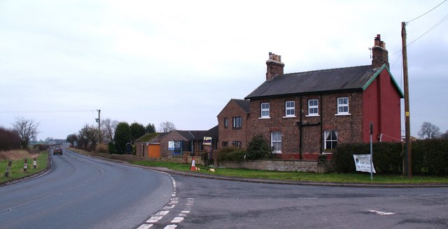
Image: © Gordon Hatton Taken: 28 Feb 2011
The A61 heads south towards the A1[M] and Ripon, whilst Hergill Lane to the right is now a dead end, its link to the A1 having now been cut. The house on the corner must be a former railway property as there was once a coal yard behind it with Baldersby Station [now demolished] close to where the three evergreen trees can be seen left of centre. The house is shown on 1892 maps but not on that of 1856.
Images are licensed for reuse under creativecommons.org/licenses/by-sa/2.0
Image Location
Latitude
54.19736
Longitude
-1.460732