
United Reformed Church beside Glasgow Road
Introduction
The photograph on this page of United Reformed Church beside Glasgow Road by Lairich Rig as part of the Geograph project.
The Geograph project started in 2005 with the aim of publishing, organising and preserving representative images for every square kilometre of Great Britain, Ireland and the Isle of Man.

There are currently over 7.5m images from over 14,400 individuals and you can help contribute to the project by visiting https://www.geograph.org.uk
United Reformed Church beside Glasgow Road
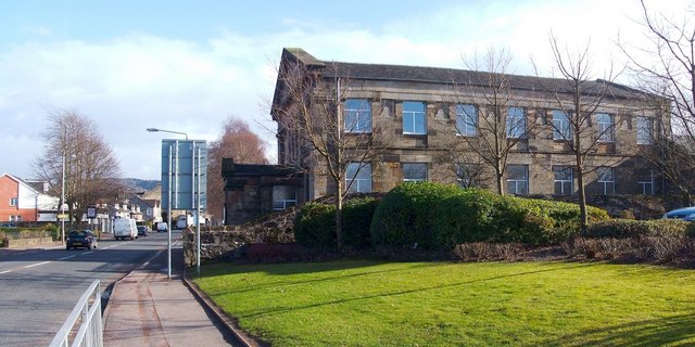
Image: © Lairich Rig Taken: 24 Feb 2011
For a view from a different angle, see Image The church (formerly Evangelical Union) is located at the corner of Glasgow Road (the main road that is visible on the left) and Leven Street (which is behind the church). Its listed building report provides further details: http://portal.historic-scotland.gov.uk/designation/LB50543 (at Historic Environment Scotland). The building is category C listed. The text "CENTENARY 1878 1978" is inscribed on the side that faces Glasgow Road. Thomas Dykes of Glasgow was the architect, and the building cost £3000, of which £1000 was contributed by the confectioner John Buchanan, who lived at Dumbuck House [Donald MacLeod, "Dumbarton Ancient and Modern" (1893), Chapter XXXIV]. By 2013, the church had closed.
Images are licensed for reuse under creativecommons.org/licenses/by-sa/2.0
Image Location

Latitude
55.943196
Longitude
-4.560285