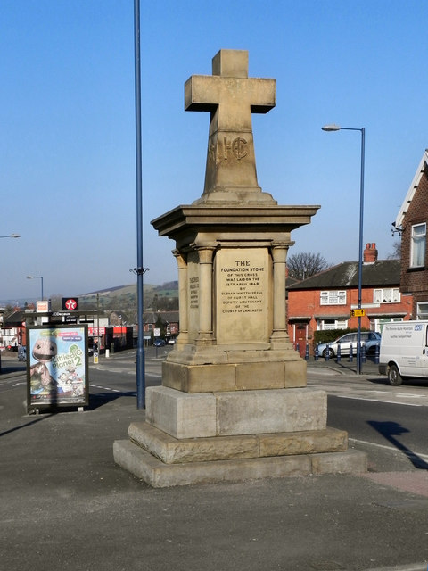
Hurst Cross
Introduction
The photograph on this page of Hurst Cross by David Dixon as part of the Geograph project.
The Geograph project started in 2005 with the aim of publishing, organising and preserving representative images for every square kilometre of Great Britain, Ireland and the Isle of Man.
There are currently over 7.5m images from over 14,400 individuals and you can help contribute to the project by visiting https://www.geograph.org.uk

Image: © David Dixon Taken: 2 Mar 2011
(If only we could Photoshop out those lampposts!) Hurst Cross is the name of a small area of Ashton-Under-Lyne. In the first half of the nineteenth century, Hurst Cross was a very small hamlet composed of a single street, commencing at where the cemetery is now and ending where Image] is now (see https://web.archive.org/web/20060620100649/http://www.certificates.fsnet.co.uk/OLDHURST.htm for Aaron Miller's recollections of Hurst and Hurst brook from 1832). This substantial stone cross was built in 1868 - presumably the road from Ashton to Lees had been made by then. It is at the junction of King's Road with Queen's Road and Lees Road. It is interesting to compare the view now, with http://www.c5d.co.uk/hurstpages.php , a photograph taken ca1900

