Crispe Almshouses, Marshfield
Introduction
The photograph on this page of Crispe Almshouses, Marshfield by Eirian Evans as part of the Geograph project.
The Geograph project started in 2005 with the aim of publishing, organising and preserving representative images for every square kilometre of Great Britain, Ireland and the Isle of Man.

There are currently over 7.5m images from over 14,400 individuals and you can help contribute to the project by visiting https://www.geograph.org.uk
Crispe Almshouses, Marshfield
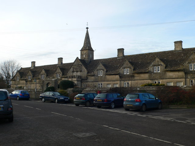
Image: © Eirian Evans Taken: 16 Feb 2011
A row of 8 almshouses and central chapel, dated "1612" - "1619", for the Crispe family at the entry into Marshfield from the west. Each of the houses originally consisted of one room with a stone spiral staircase in one corner leading to a bedroom above. Earth closets at the top of the back gardens and a well in front of No 5 served the residents until 1939, when water and sewage services were connected. An extension at the rear of the houses in 1977 provided a kitchen and bathroom/toilet downstairs and a modern staircase for each house, plus central heating.
Images are licensed for reuse under creativecommons.org/licenses/by-sa/2.0
Image Location
Latitude
51.462447
Longitude
-2.326703