Housing on Master Gunner Place
Introduction
The photograph on this page of Housing on Master Gunner Place by Stephen Craven as part of the Geograph project.
The Geograph project started in 2005 with the aim of publishing, organising and preserving representative images for every square kilometre of Great Britain, Ireland and the Isle of Man.

There are currently over 7.5m images from over 14,400 individuals and you can help contribute to the project by visiting https://www.geograph.org.uk
Housing on Master Gunner Place
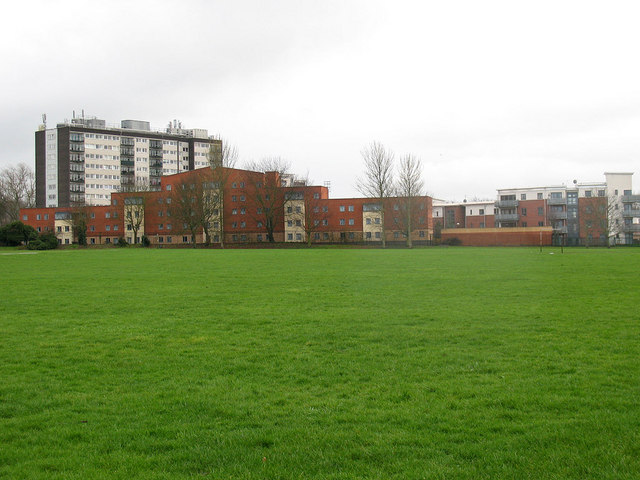
Image: © Stephen Craven Taken: 27 Feb 2011
The high-rise block in this view is Greenwich Heights. I have not found a name for the newer, lower rise blocks in the foreground. They overlook Hornfair Park (foreground). The name of the road they are on recalls the Heights' origin as military accommodation.
Images are licensed for reuse under creativecommons.org/licenses/by-sa/2.0
Image Location
Latitude
51.474974
Longitude
0.047436