Mutton Brook in Hampstead Garden Suburb
Introduction
The photograph on this page of Mutton Brook in Hampstead Garden Suburb by Nigel Cox as part of the Geograph project.
The Geograph project started in 2005 with the aim of publishing, organising and preserving representative images for every square kilometre of Great Britain, Ireland and the Isle of Man.

There are currently over 7.5m images from over 14,400 individuals and you can help contribute to the project by visiting https://www.geograph.org.uk
Mutton Brook in Hampstead Garden Suburb
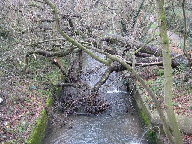
Image: © Nigel Cox Taken: 20 Feb 2011
Mutton Brook eventually merges with Dollis Brook to form the River Brent. It is seen here looking downstream from the Brookland Rise bridge, where a large tree has fallen across it and has the potential to create a flood situation. If debris brought downstream from elsewhere in a heavy flow event accumulates against the branches in the brook it could eventually block the brook and force the water to flow out of bank. The co-ordinates of the subject and photographer positions are taken from the Ordnance Survey 1:10,000 scale mapping because the 1:50,000 scale mapping is cartographically badly distorted by the need to represent the nearby A1 much wider than it actually is.
Images are licensed for reuse under creativecommons.org/licenses/by-sa/2.0
Image Location
Latitude
51.587257
Longitude
-0.191193