Bridgewater Canal, Approaching Worsley
Introduction
The photograph on this page of Bridgewater Canal, Approaching Worsley by David Dixon as part of the Geograph project.
The Geograph project started in 2005 with the aim of publishing, organising and preserving representative images for every square kilometre of Great Britain, Ireland and the Isle of Man.

There are currently over 7.5m images from over 14,400 individuals and you can help contribute to the project by visiting https://www.geograph.org.uk
Bridgewater Canal, Approaching Worsley
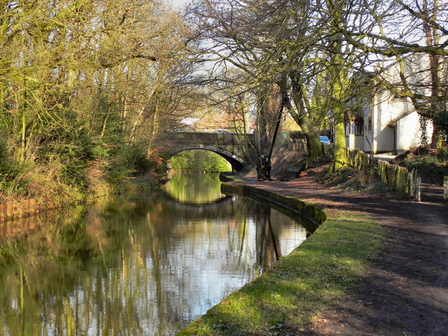
Image: © David Dixon Taken: 24 Feb 2011
Approaching Worsley, from the west, along the towpath of The Bridgewater Canal. Note the indentation in the bank ahead and the crane (Image] almost hidden under the trees) on the right. This is to allow boards to be dropped into slots in the banks. This allows sections of the canal to be isolated in the event of a leak. The bridge in the background is Image
Images are licensed for reuse under creativecommons.org/licenses/by-sa/2.0
Image Location
Latitude
53.499236
Longitude
-2.38211