Standard Hill Triangulation Pillar
Introduction
The photograph on this page of Standard Hill Triangulation Pillar by Rossographer as part of the Geograph project.
The Geograph project started in 2005 with the aim of publishing, organising and preserving representative images for every square kilometre of Great Britain, Ireland and the Isle of Man.

There are currently over 7.5m images from over 14,400 individuals and you can help contribute to the project by visiting https://www.geograph.org.uk
Standard Hill Triangulation Pillar
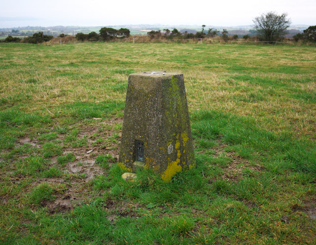
Image: © Rossographer Taken: 22 Feb 2011
Trig pillar situated on a hill between Holywood and Dundonald in north County Down. The pillar lies in a field accessed from Church Road and is in excellent condition, although it has been partially buried - an earlier picture at http://www.trigpointing-ireland.org.uk/one_image.php?i=278 shows the full pillar. On a clear day the views are excellent in all directions. See also Image and Image I am unsure why this has been named 'Standard Hill' as I can find no trace of that name on any map. The townland is Ballykeel.
Images are licensed for reuse under creativecommons.org/licenses/by-sa/2.0
Image Location
Latitude
54.625634
Longitude
-5.808157