Flush Bracket, Whitchurch
Introduction
The photograph on this page of Flush Bracket, Whitchurch by Neil Owen as part of the Geograph project.
The Geograph project started in 2005 with the aim of publishing, organising and preserving representative images for every square kilometre of Great Britain, Ireland and the Isle of Man.

There are currently over 7.5m images from over 14,400 individuals and you can help contribute to the project by visiting https://www.geograph.org.uk
Flush Bracket, Whitchurch
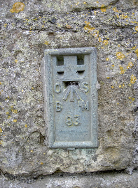
Image: © Neil Owen Taken: 18 Feb 2011
A fairly uncommon example of a flush bracket, embedded in the wall of a farm building. The bracket is part of the Second Geodetic Levelling of England and Wales, dating from late 1912. It gives the height of the mark as 80.17m (263ft) above Newlyn sea level, and was last officially surveyed in 1957. See Image] for a wider view and http://www.bench-marks.org.uk/bm2688 for the Benchmark Database.
Images are licensed for reuse under creativecommons.org/licenses/by-sa/2.0
Image Location
Latitude
51.405622
Longitude
-2.56308