Lostwithiel Bridge viewed from downstream
Introduction
The photograph on this page of Lostwithiel Bridge viewed from downstream by Rod Allday as part of the Geograph project.
The Geograph project started in 2005 with the aim of publishing, organising and preserving representative images for every square kilometre of Great Britain, Ireland and the Isle of Man.

There are currently over 7.5m images from over 14,400 individuals and you can help contribute to the project by visiting https://www.geograph.org.uk
Lostwithiel Bridge viewed from downstream
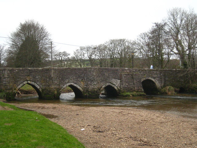
Image: © Rod Allday Taken: 20 Feb 2011
This ancient bridge, being the lowest crossing across the River Fowey, dates from the mid C15th and is a scheduled ancient monument and Grade I listed structure. The river is tidal at this point and the tide is low at the time of the photograph.
Images are licensed for reuse under creativecommons.org/licenses/by-sa/2.0
Image Location
Latitude
50.407561
Longitude
-4.666832