Gas installation, Foord Road North (A2033), Folkestone
Introduction
The photograph on this page of Gas installation, Foord Road North (A2033), Folkestone by John Baker as part of the Geograph project.
The Geograph project started in 2005 with the aim of publishing, organising and preserving representative images for every square kilometre of Great Britain, Ireland and the Isle of Man.

There are currently over 7.5m images from over 14,400 individuals and you can help contribute to the project by visiting https://www.geograph.org.uk
Gas installation, Foord Road North (A2033), Folkestone
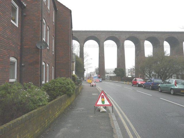
Image: © John Baker Taken: 20 Feb 2011
A deep trench has been excavated in the left carriageway for the gas pipes, which has necessitated traffic lights being installed to control the flow of traffic. The viaduct carries the railway line between Folkestone Central and Dover Priory stations.
Images are licensed for reuse under creativecommons.org/licenses/by-sa/2.0
Image Location
Latitude
51.082937
Longitude
1.178854