Trinity Church, Debden
Introduction
The photograph on this page of Trinity Church, Debden by Stephen Craven as part of the Geograph project.
The Geograph project started in 2005 with the aim of publishing, organising and preserving representative images for every square kilometre of Great Britain, Ireland and the Isle of Man.

There are currently over 7.5m images from over 14,400 individuals and you can help contribute to the project by visiting https://www.geograph.org.uk
Trinity Church, Debden
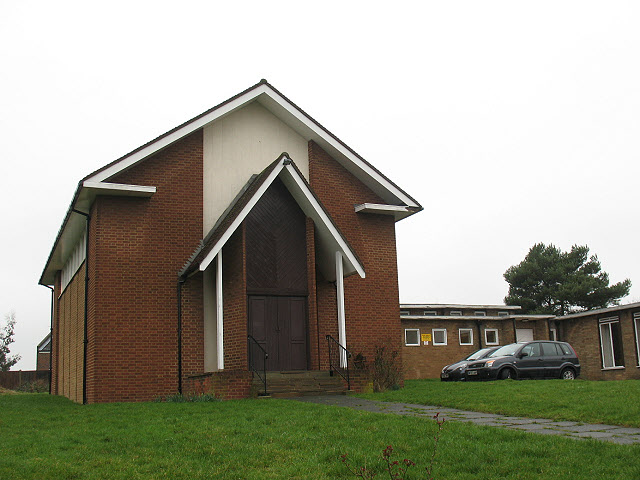
Image: © Stephen Craven Taken: 19 Feb 2011
Trinity Church stands at the top of the hill on the western side of Mannock Drive. It is a Methodist church building with a joint Anglican/ Methodist congregation, erected to serve the housing estate which forms the eastern edges of Debden. (Text courtesy of Peter Kessler http://www.historyfiles.co.uk/ChurchesBritain/East/Essex_Epping05.htm) The Debden Estate was constructed between 1947 and 1952 although the church may be a little later.
Images are licensed for reuse under creativecommons.org/licenses/by-sa/2.0
Image Location
Latitude
51.654934
Longitude
0.082283