Hilton House
Introduction
The photograph on this page of Hilton House by Anne Burgess as part of the Geograph project.
The Geograph project started in 2005 with the aim of publishing, organising and preserving representative images for every square kilometre of Great Britain, Ireland and the Isle of Man.

There are currently over 7.5m images from over 14,400 individuals and you can help contribute to the project by visiting https://www.geograph.org.uk
Hilton House
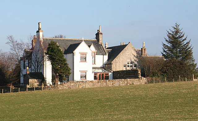
Image: © Anne Burgess Taken: 17 Feb 2011
Appearances are deceptive. This is taken from the public road just west of the crossroads at Hilton, and it looks as if there are only fields in between. In fact the other road from the crossroads runs between this field and the house. The wing to the right has the look of a school about it, and sure enough the Victorian six-inch map shows a school here.
Images are licensed for reuse under creativecommons.org/licenses/by-sa/2.0
Image Location
Latitude
57.634183
Longitude
-2.601372