
Peffermill House
Introduction
The photograph on this page of Peffermill House by kim traynor as part of the Geograph project.
The Geograph project started in 2005 with the aim of publishing, organising and preserving representative images for every square kilometre of Great Britain, Ireland and the Isle of Man.

There are currently over 7.5m images from over 14,400 individuals and you can help contribute to the project by visiting https://www.geograph.org.uk
Peffermill House
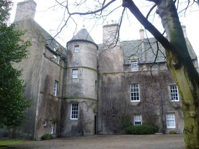
Image: © kim traynor Taken: 17 Feb 2011
Standing on a haugh of the Braid Burn to the south of Duddingston Loch and lands of Prestonfield, this magnificent house is described in Nigel Tranter's 'The Fortified House In Scotland' as "a very typical laird's house of the first half of the 17th century". He points out that before modern drainage the surrounding marshlands (described in the 12thC foundation charter of Holyrood Abbey as the 'common myre') would have constituted its primary defence. The original owner was Edward Elgar who acquired the lands from the Prestons of Craigmillar. A carved panel on the north side bears the date 1636.
Images are licensed for reuse under creativecommons.org/licenses/by-sa/2.0
Image Location

Latitude
55.932547
Longitude
-3.148884