Church at Lower Peover
Introduction
The photograph on this page of Church at Lower Peover by Stephen Nunney as part of the Geograph project.
The Geograph project started in 2005 with the aim of publishing, organising and preserving representative images for every square kilometre of Great Britain, Ireland and the Isle of Man.

There are currently over 7.5m images from over 14,400 individuals and you can help contribute to the project by visiting https://www.geograph.org.uk
Church at Lower Peover
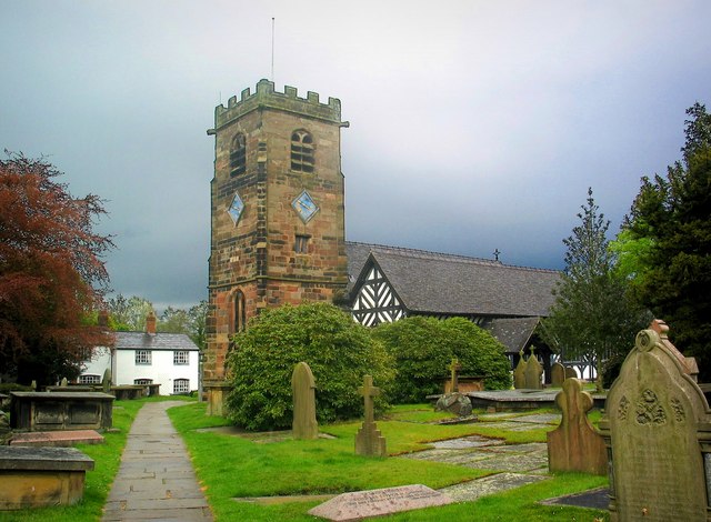
Image: © Stephen Nunney Taken: Unknown
The body of the church with its black and white timbering dates from the 14th century. The Perpendicular stone tower is a later addition, built in 1582.
Images are licensed for reuse under creativecommons.org/licenses/by-sa/2.0
Image Location
Latitude
53.266874
Longitude
-2.383782