Doctor's house, Ironville
Introduction
The photograph on this page of Doctor's house, Ironville by S Parish as part of the Geograph project.
The Geograph project started in 2005 with the aim of publishing, organising and preserving representative images for every square kilometre of Great Britain, Ireland and the Isle of Man.

There are currently over 7.5m images from over 14,400 individuals and you can help contribute to the project by visiting https://www.geograph.org.uk
Doctor's house, Ironville
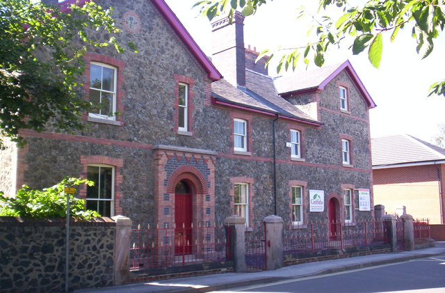
Image: © S Parish Taken: 24 Aug 2006
Built as a doctor's house by the local mineowner, the building is made of iron slag. Currently being converted to apartments. The first doctor appointed (who was due to marry the mineowner's daughter) was killed in an accident.
Images are licensed for reuse under creativecommons.org/licenses/by-sa/2.0
Image Location
Latitude
53.060777
Longitude
-1.350877