The Green, Winchmore Hill
Introduction
The photograph on this page of The Green, Winchmore Hill by Martin Addison as part of the Geograph project.
The Geograph project started in 2005 with the aim of publishing, organising and preserving representative images for every square kilometre of Great Britain, Ireland and the Isle of Man.

There are currently over 7.5m images from over 14,400 individuals and you can help contribute to the project by visiting https://www.geograph.org.uk
The Green, Winchmore Hill
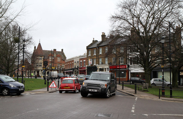
Image: © Martin Addison Taken: 12 Feb 2011
A steady stream of traffic using this route which provides a handy cut through to Enfield Road. Up the hill to the left of centre is The Kings Head, at the junction with Wades Hill. The junction in the foreground is with Broad Walk.
Images are licensed for reuse under creativecommons.org/licenses/by-sa/2.0
Image Location
Latitude
51.633699
Longitude
-0.102644