2011 : A431 Bryants Hill, Hanham
Introduction
The photograph on this page of 2011 : A431 Bryants Hill, Hanham by Maurice Pullin as part of the Geograph project.
The Geograph project started in 2005 with the aim of publishing, organising and preserving representative images for every square kilometre of Great Britain, Ireland and the Isle of Man.

There are currently over 7.5m images from over 14,400 individuals and you can help contribute to the project by visiting https://www.geograph.org.uk
2011 : A431 Bryants Hill, Hanham
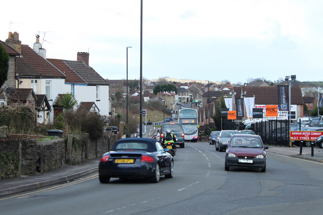
Image: © Maurice Pullin Taken: 14 Feb 2011
A mixture of houses and other buildings of varying ages from the old cottages on the left, probably used by coal miners from the Troopers Hill mine to the modern houses further down the hill, the enlarged version gives more detail at the bottom. The No.44 bus is on its way to the City Centre. Away in the distance, almost centre, Kelston Round Hill is recognisable on the skyline. Image
Images are licensed for reuse under creativecommons.org/licenses/by-sa/2.0
Image Location
Latitude
51.45167
Longitude
-2.521768