The South Circular Road, at Lee, SE12: St Mildred's Road
Introduction
The photograph on this page of The South Circular Road, at Lee, SE12: St Mildred's Road by Stefan Czapski as part of the Geograph project.
The Geograph project started in 2005 with the aim of publishing, organising and preserving representative images for every square kilometre of Great Britain, Ireland and the Isle of Man.

There are currently over 7.5m images from over 14,400 individuals and you can help contribute to the project by visiting https://www.geograph.org.uk
The South Circular Road, at Lee, SE12: St Mildred's Road
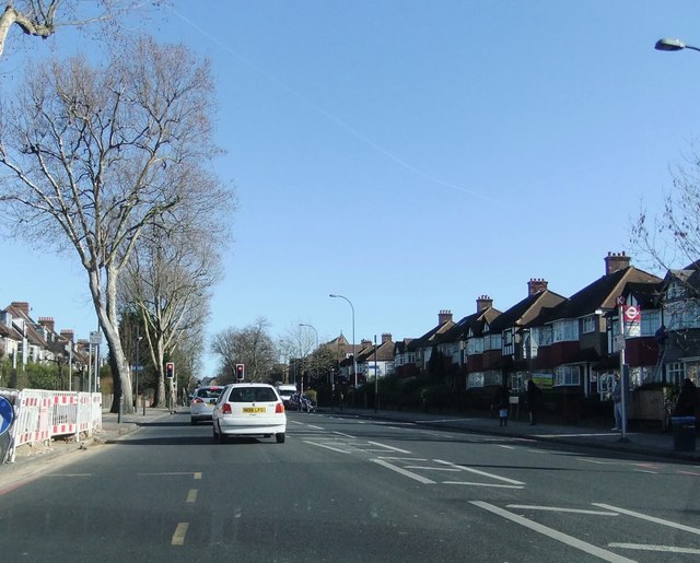
Image: © Stefan Czapski Taken: 8 Feb 2011
This stretch of the South Circular will be familiar to many people who (like myself) know little or nothing of the rest of the grid-square. The view is eastward, with the roof of St Mildred's Church visible in the distance. The plane trees gleam in the February sunshine. Unlike the North Circular, which was largely purpose-built, engineering the South Circular amounted to little more than putting up signs to indicate the route - along existing roads. To road enthusiasts the South Circular is a bad joke - but the rest of us are probably grateful that swathes were not cut through South London's older local centres (Putney, say, or Battersea Rise). The price to be paid remains the presence of heavy through traffic in residential and shopping streets.
Images are licensed for reuse under creativecommons.org/licenses/by-sa/2.0
Image Location
Latitude
51.445681
Longitude
0.009716