North end of The Green, Snitterfield
Introduction
The photograph on this page of North end of The Green, Snitterfield by Robin Stott as part of the Geograph project.
The Geograph project started in 2005 with the aim of publishing, organising and preserving representative images for every square kilometre of Great Britain, Ireland and the Isle of Man.

There are currently over 7.5m images from over 14,400 individuals and you can help contribute to the project by visiting https://www.geograph.org.uk
North end of The Green, Snitterfield
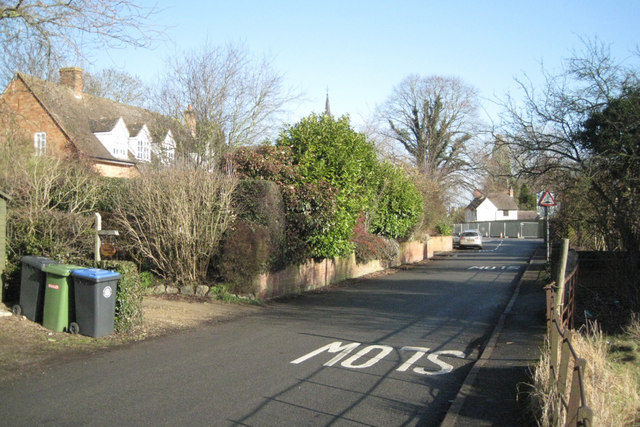
Image: © Robin Stott Taken: 3 Feb 2011
The Green, a residential road, runs roughly southwest from the centre of the village. Visible across Smith's Lane at the end of the road is the hoarding around the burnt-out Foxhunter pub (just out of sight). The spire of the Methodist church appears above the cherry laurels. At lower right is the fence and gate to a small overgrown paddock.
Images are licensed for reuse under creativecommons.org/licenses/by-sa/2.0
Image Location
Latitude
52.235989
Longitude
-1.690983