Commemorative plaque at the Round School (now The Study), Camp Road, Wimbledon Common
Introduction
The photograph on this page of Commemorative plaque at the Round School (now The Study), Camp Road, Wimbledon Common by Stefan Czapski as part of the Geograph project.
The Geograph project started in 2005 with the aim of publishing, organising and preserving representative images for every square kilometre of Great Britain, Ireland and the Isle of Man.

There are currently over 7.5m images from over 14,400 individuals and you can help contribute to the project by visiting https://www.geograph.org.uk
Commemorative plaque at the Round School (now The Study), Camp Road, Wimbledon Common
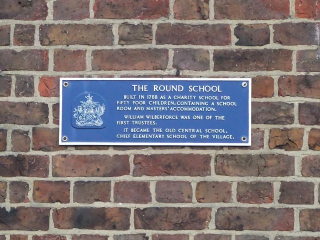
Image: © Stefan Czapski Taken: 12 Feb 2011
For a general view of the building, and some notes on its history, see: Image
Images are licensed for reuse under creativecommons.org/licenses/by-sa/2.0
Image Location


Leaflet Map data © OpenStreetMap
Latitude
51.426285
Longitude
-0.231935