Corduroy Road at Dormans Park
Introduction
The photograph on this page of Corduroy Road at Dormans Park by Tom Walsingham as part of the Geograph project.
The Geograph project started in 2005 with the aim of publishing, organising and preserving representative images for every square kilometre of Great Britain, Ireland and the Isle of Man.

There are currently over 7.5m images from over 14,400 individuals and you can help contribute to the project by visiting https://www.geograph.org.uk
Corduroy Road at Dormans Park
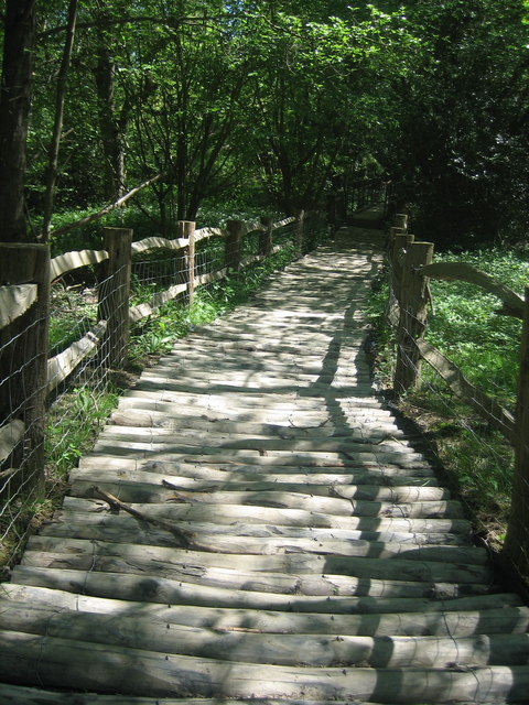
Image: © Tom Walsingham Taken: 24 May 2010
This 'Corduroy Road' is a reconstruction of a prehistoric path across swampy ground on Public Footpath 426, Dormansland. The earliest evidence of these roads is dated at around 4000BC from near Glastonbury and they were well used up to and including Roman times. This one was built by volunteers from the East Surrey Ramblers group. For more information please visit http://en.wikipedia.org/wiki/Corduroy_road .
Images are licensed for reuse under creativecommons.org/licenses/by-sa/2.0
Image Location
Latitude
51.15406
Longitude
-0.012563