East Street, Newtownards
Introduction
The photograph on this page of East Street, Newtownards by Albert Bridge as part of the Geograph project.
The Geograph project started in 2005 with the aim of publishing, organising and preserving representative images for every square kilometre of Great Britain, Ireland and the Isle of Man.

There are currently over 7.5m images from over 14,400 individuals and you can help contribute to the project by visiting https://www.geograph.org.uk
East Street, Newtownards
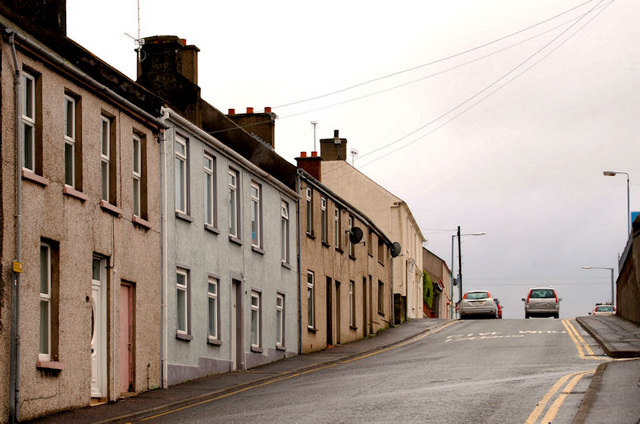
Image: © Albert Bridge Taken: 7 Feb 2011
Newtownards was a planned Plantation town, laid out in the early part of the 17th century, on lands granted to Sir Hugh Montgomery Image Four of the streets are named after the points of the compass. This is part of East Street as it rises towards the Bangor and Donaghadee Roads.
Images are licensed for reuse under creativecommons.org/licenses/by-sa/2.0
Image Location
Latitude
54.594268
Longitude
-5.691775