Junction of Gold Street & Drapery, Northampton, c.1968
Introduction
The photograph on this page of Junction of Gold Street & Drapery, Northampton, c.1968 by John Brightley collection as part of the Geograph project.
The Geograph project started in 2005 with the aim of publishing, organising and preserving representative images for every square kilometre of Great Britain, Ireland and the Isle of Man.

There are currently over 7.5m images from over 14,400 individuals and you can help contribute to the project by visiting https://www.geograph.org.uk
Junction of Gold Street & Drapery, Northampton, c.1968
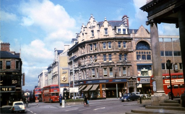
Image: © John Brightley collection Taken: Unknown
An interesting scene with old buses, cars and road signs. The portico of All Saints Church can be seen on the right. Much of this area is now pedestrianised. The approximate date of 1968 is a best guess based on the cars and information on other slides which were in the same set. If you can date the image more accurately please let me know. For a view on the same date looking in the opposite direction see Image] For a similar view from the Francis Frith collection taken in 1955 see http://www.francisfrith.com/northampton/photos/gold-street-c1955_N40057/
Images are licensed for reuse under creativecommons.org/licenses/by-sa/2.0
Image Location
Latitude
52.236908
Longitude
-0.897281