The Old Vicarage
Introduction
The photograph on this page of The Old Vicarage by Hugh Craddock as part of the Geograph project.
The Geograph project started in 2005 with the aim of publishing, organising and preserving representative images for every square kilometre of Great Britain, Ireland and the Isle of Man.

There are currently over 7.5m images from over 14,400 individuals and you can help contribute to the project by visiting https://www.geograph.org.uk
The Old Vicarage
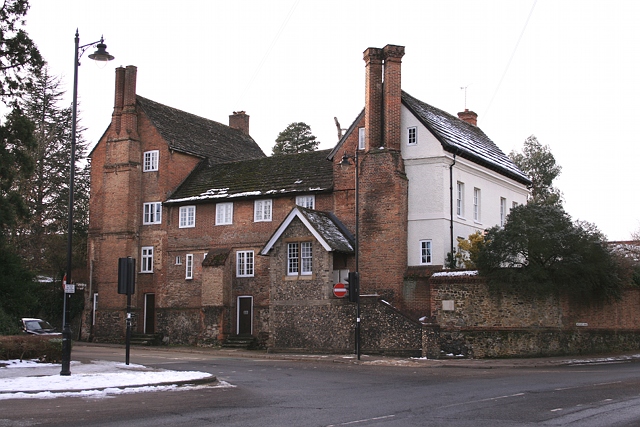
Image: © Hugh Craddock Taken: 26 Dec 2010
It's hard to believe such a vast building could have been occupied by the vicar of St Martin's (the vicar now lives next door, around the corner in Westcott Road). The building was known as Sondes Place until 1839, and is a large tall house of half H plan, listed grade II. The south wing is the oldest portion, being C17 or earlier. The roof is Horsham slab. Even the stables behind are listed grade II, also dating from the C17.
Images are licensed for reuse under creativecommons.org/licenses/by-sa/2.0
Image Location
Latitude
51.231445
Longitude
-0.338389