Poole: quayside frontages
Introduction
The photograph on this page of Poole: quayside frontages by Chris Downer as part of the Geograph project.
The Geograph project started in 2005 with the aim of publishing, organising and preserving representative images for every square kilometre of Great Britain, Ireland and the Isle of Man.

There are currently over 7.5m images from over 14,400 individuals and you can help contribute to the project by visiting https://www.geograph.org.uk
Poole: quayside frontages
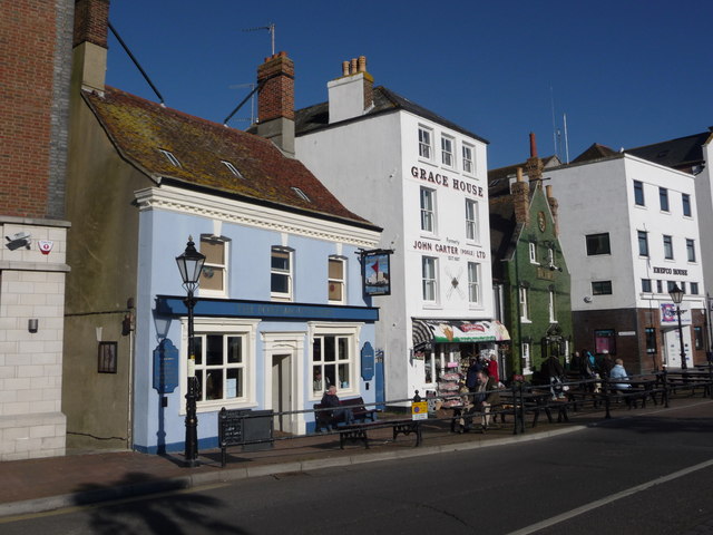
Image: © Chris Downer Taken: 30 Jan 2011
Apart from the number of tourists attracted to Poole's historic town centre, the pubs lining they quay make for a popular pub crawl. Here we see two of them, the Portsmouth Hoy and the wonderful bottle-green facade of the Poole Arms. Between them, Grace House was once the Britannia Inn.
Images are licensed for reuse under creativecommons.org/licenses/by-sa/2.0
Image Location
Latitude
50.712242
Longitude
-1.987484