Hopton's Almshouses
Introduction
The photograph on this page of Hopton's Almshouses by Richard Law as part of the Geograph project.
The Geograph project started in 2005 with the aim of publishing, organising and preserving representative images for every square kilometre of Great Britain, Ireland and the Isle of Man.

There are currently over 7.5m images from over 14,400 individuals and you can help contribute to the project by visiting https://www.geograph.org.uk
Hopton's Almshouses
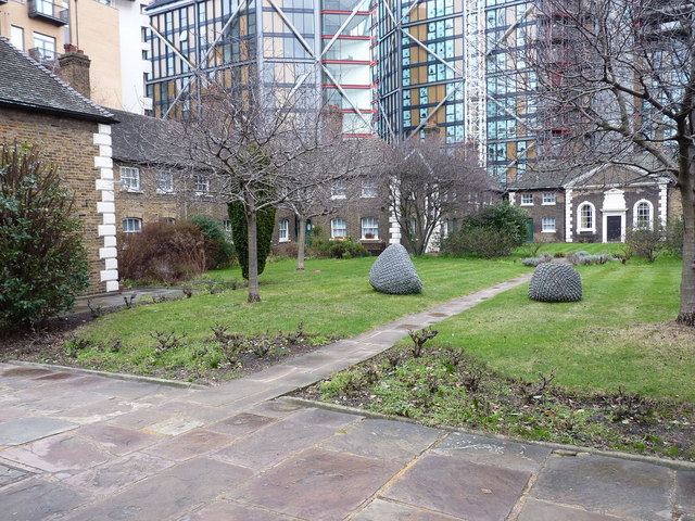
Image: © Richard Law Taken: 22 Jan 2011
The collection of 26 almshouses here on the south side of the river is now dwarfed and rather overshadowed by the surrounding high-rise developments, but the properties have been in continuous occupation since 1752, when they were built with money provided by the estate of a wealthy businessman, Charles Hopton.
Images are licensed for reuse under creativecommons.org/licenses/by-sa/2.0
Image Location
Latitude
51.506261
Longitude
-0.101747