Tyttenhanger: Gravel pit conveyor belt
Introduction
The photograph on this page of Tyttenhanger: Gravel pit conveyor belt by Nigel Cox as part of the Geograph project.
The Geograph project started in 2005 with the aim of publishing, organising and preserving representative images for every square kilometre of Great Britain, Ireland and the Isle of Man.

There are currently over 7.5m images from over 14,400 individuals and you can help contribute to the project by visiting https://www.geograph.org.uk
Tyttenhanger: Gravel pit conveyor belt
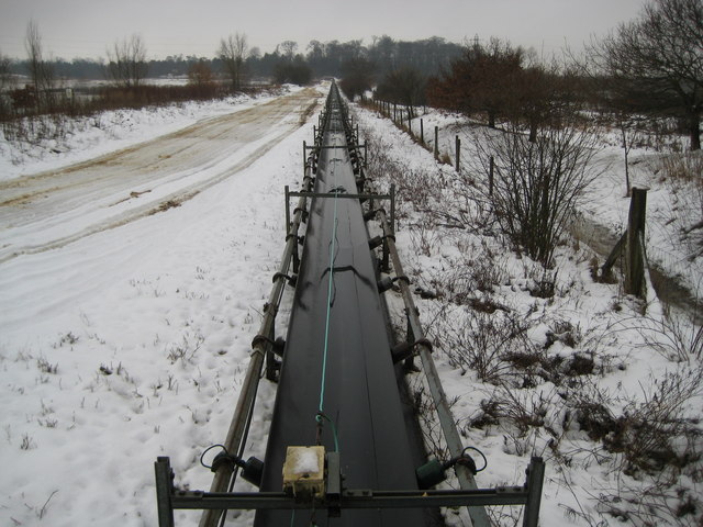
Image: © Nigel Cox Taken: 14 Jan 2010
Reviewing old Ordnance Survey maps of this area the abstraction of gravel appears to be a comparatively recent development, with a 1960s 1:10,000 scale map showing the original hedge and field layout alongside the River Colne largely intact since historic times. By 1971 though the first gravel pits had appeared on the mapping, and the area is currently actively worked. On the day of the photograph the belt was running but not carrying gravel. This view was taken from the bridge carrying a public footpath over the conveyor belt. For a view in the opposite direction please see Image
Images are licensed for reuse under creativecommons.org/licenses/by-sa/2.0
Image Location
Latitude
51.734624
Longitude
-0.273801