Betts Park, Anerley: last trace of the Croydon Canal
Introduction
The photograph on this page of Betts Park, Anerley: last trace of the Croydon Canal by Christopher Hilton as part of the Geograph project.
The Geograph project started in 2005 with the aim of publishing, organising and preserving representative images for every square kilometre of Great Britain, Ireland and the Isle of Man.

There are currently over 7.5m images from over 14,400 individuals and you can help contribute to the project by visiting https://www.geograph.org.uk
Betts Park, Anerley: last trace of the Croydon Canal
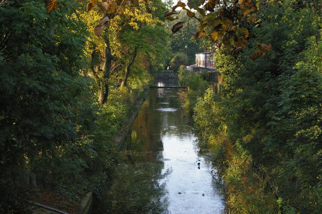
Image: © Christopher Hilton Taken: 13 Oct 2009
The Croydon Canal was built in the early nineteenth century, running from the Grand Surrey Canal north of the present New Cross Gate station, to a basin under the site of the present West Croydon station. As those details suggest, it was later bought by a railway company and much of its trackbed used by what became the London, Brighton and South Coast Railway's main line south. Where the canal swung off the straighter course of the railway it has largely been built over. Here in Anerley, however, the canal did an S-bend around some curves in the land whilst the later railway carved straight through them, and a short stretch of the canal survives a hundred yards or so off the railway line, converted to an ornamental lake in Betts Park. The only other surviving piece of canal infrastructure is its reservoir half a mile south-west of here, now South Norwood Lake and like this preserved by being in a park.
Images are licensed for reuse under creativecommons.org/licenses/by-sa/2.0
Image Location
Latitude
51.409445
Longitude
-0.065353