Brewer Street Farm House
Introduction
The photograph on this page of Brewer Street Farm House by Ian Capper as part of the Geograph project.
The Geograph project started in 2005 with the aim of publishing, organising and preserving representative images for every square kilometre of Great Britain, Ireland and the Isle of Man.

There are currently over 7.5m images from over 14,400 individuals and you can help contribute to the project by visiting https://www.geograph.org.uk
Brewer Street Farm House
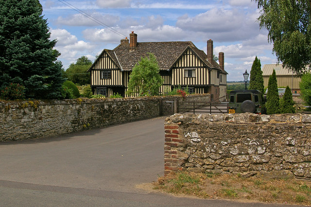
Image: © Ian Capper Taken: 3 Jul 2010
A former hall, dating originally from the 15th century and considered to be an excellent example of its type. Grade I listed - for listing particulars see www.historicengland.org.uk/listing/the-list/list-entry/1281258.
Images are licensed for reuse under creativecommons.org/licenses/by-sa/2.0
Image Location
Latitude
51.251188
Longitude
-0.104346