Albert Embankment (1)
Introduction
The photograph on this page of Albert Embankment (1) by Stephen Richards as part of the Geograph project.
The Geograph project started in 2005 with the aim of publishing, organising and preserving representative images for every square kilometre of Great Britain, Ireland and the Isle of Man.

There are currently over 7.5m images from over 14,400 individuals and you can help contribute to the project by visiting https://www.geograph.org.uk
Albert Embankment (1)
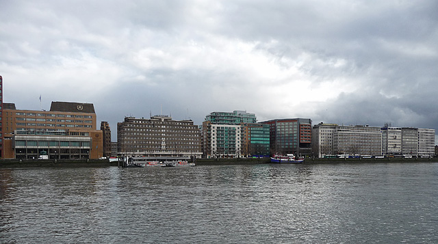
Image: © Stephen Richards Taken: Unknown
Running south from Lambeth Bridge (left of shot) towards Vauxhall Bridge. The yellow-brick building on the left is the International Maritime Organisation (1977-82, by Douglas Marriott, Worby and Robinson Image]). Its neighbour is the former Fire Brigade Headquarters, (1937, by E.P. Wheeler of the London County Council Image]) - big, brick and horizontal. After a couple of modern blocks are a run of post-war office blocks described by Pevsner as, "bland facades with no emphasis anywhere apart from a few attempts to liven the roof-lines with free-standing grids". See here for a closer view: Image] The Albert Embankment, built out by Joseph Bazalgette in 1866-69, was primarily an industrial area until the Second World War after which commerce moved in.
Images are licensed for reuse under creativecommons.org/licenses/by-sa/2.0
Image Location
Latitude
51.49273
Longitude
-0.121468