Sewage Works at RAF Peterhead
Introduction
The photograph on this page of Sewage Works at RAF Peterhead by Iain Smith as part of the Geograph project.
The Geograph project started in 2005 with the aim of publishing, organising and preserving representative images for every square kilometre of Great Britain, Ireland and the Isle of Man.

There are currently over 7.5m images from over 14,400 individuals and you can help contribute to the project by visiting https://www.geograph.org.uk
Sewage Works at RAF Peterhead
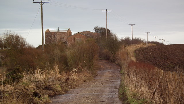
Image: © Iain Smith Taken: 22 Jan 2011
Sewage/Water works for the former WW2 airfield between Peterhead and Longside. Photograph taken from a padlocked gate, where warning signs indicating unstable brickwork and deep excavations are posted. The CANMORE site record can be found here: http://canmore.rcahms.gov.uk/en/site/181065/details/peterhead+airfield+meadowbank/
Images are licensed for reuse under creativecommons.org/licenses/by-sa/2.0
Image Location
Latitude
57.512826
Longitude
-1.849764