Pixham Lane
Introduction
The photograph on this page of Pixham Lane by Ian Capper as part of the Geograph project.
The Geograph project started in 2005 with the aim of publishing, organising and preserving representative images for every square kilometre of Great Britain, Ireland and the Isle of Man.

There are currently over 7.5m images from over 14,400 individuals and you can help contribute to the project by visiting https://www.geograph.org.uk
Pixham Lane
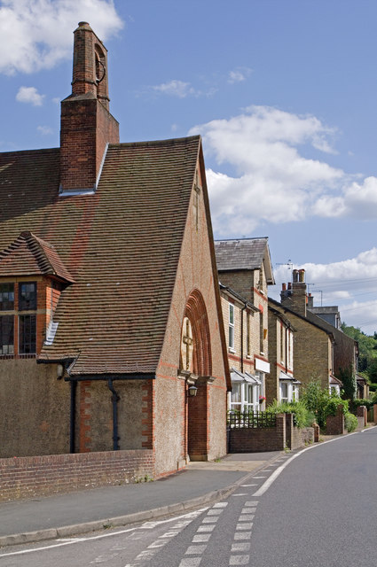
Image: © Ian Capper Taken: 5 Jul 2010
Seen here at its junction with Leslie Road. On the left is the front of Pixham Church (see Image). The gabled building beyond is the former post office which closed in 1990.
Images are licensed for reuse under creativecommons.org/licenses/by-sa/2.0
Image Location
Latitude
51.239525
Longitude
-0.316709