Preparation for Metrolink
Introduction
The photograph on this page of Preparation for Metrolink by Peter Whatley as part of the Geograph project.
The Geograph project started in 2005 with the aim of publishing, organising and preserving representative images for every square kilometre of Great Britain, Ireland and the Isle of Man.

There are currently over 7.5m images from over 14,400 individuals and you can help contribute to the project by visiting https://www.geograph.org.uk
Preparation for Metrolink
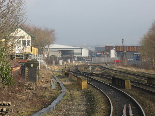
Image: © Peter Whatley Taken: 19 Jan 2011
At the north end of Rochdale station work is underway associated with the downgrading of the former Oldham loop railway to a Metrolink tram line. To enable the trams to access Rochdale's town centre, the tram line must cross the railway using an acutely skewed bridge which is visible in the background. Space and cost limitations mean that the new tramway will only be a single line between Kingsway and Rochdale station. The line will lead to demolition of Rochdale signalbox (seen left). The tramway bridge's specification calls for "natural steel", also known as unpainted or rust! Whether these extensive and very expensive works, plus associated tasks will be money wisely spent, compared to a simple bus shuttle into Rochdale from its station, time alone will tell.
Images are licensed for reuse under creativecommons.org/licenses/by-sa/2.0
Image Location
Latitude
53.613102
Longitude
-2.14507