Llanmihangel Place, Llanmihangel
Introduction
The photograph on this page of Llanmihangel Place, Llanmihangel by John Lord as part of the Geograph project.
The Geograph project started in 2005 with the aim of publishing, organising and preserving representative images for every square kilometre of Great Britain, Ireland and the Isle of Man.

There are currently over 7.5m images from over 14,400 individuals and you can help contribute to the project by visiting https://www.geograph.org.uk
Llanmihangel Place, Llanmihangel
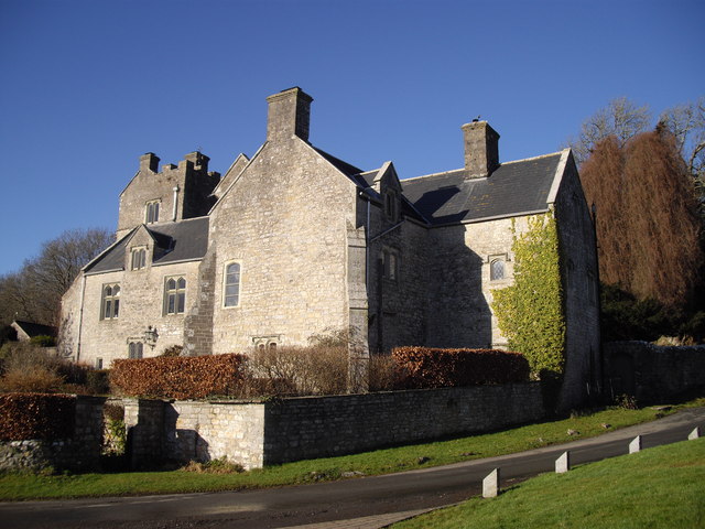
Image: © John Lord Taken: 19 Jan 2011
Built in the mid C16th, with additions in the late C16th and early C17th. In the care of Cadw.
Images are licensed for reuse under creativecommons.org/licenses/by-sa/2.0
Image Location
Latitude
51.437261
Longitude
-3.467401