Haxey and Epworth Station (2)
Introduction
The photograph on this page of Haxey and Epworth Station (2) by Jonathan Thacker as part of the Geograph project.
The Geograph project started in 2005 with the aim of publishing, organising and preserving representative images for every square kilometre of Great Britain, Ireland and the Isle of Man.

There are currently over 7.5m images from over 14,400 individuals and you can help contribute to the project by visiting https://www.geograph.org.uk
Haxey and Epworth Station (2)
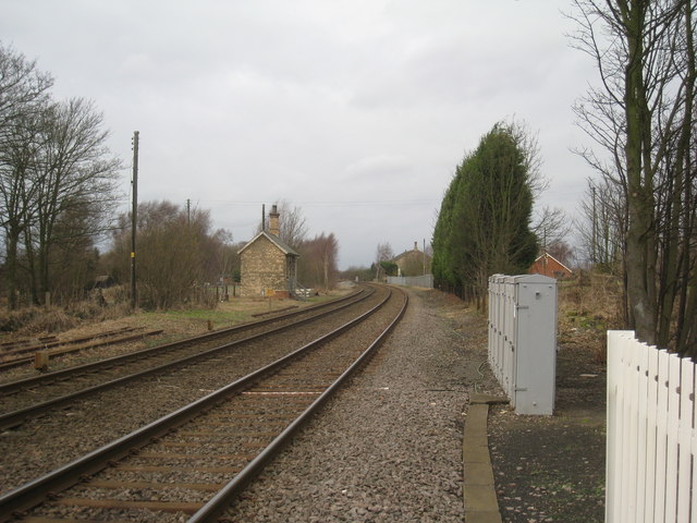
Image: © Jonathan Thacker Taken: 16 Jan 2011
The Weighbridge was on the left and the Goods Shed can be seen in the distance. The platforms and main station buildings were between the Weighbridge and the Goods Shed. The station closed in 1959. Haxey Junction Station (of the Axholme Joint Railway) was over to the right. This closed in 1933.
Images are licensed for reuse under creativecommons.org/licenses/by-sa/2.0
Image Location
Latitude
53.467203
Longitude
-0.843966