Assarts and Upper Welland
Introduction
The photograph on this page of Assarts and Upper Welland by Bob Embleton as part of the Geograph project.
The Geograph project started in 2005 with the aim of publishing, organising and preserving representative images for every square kilometre of Great Britain, Ireland and the Isle of Man.

There are currently over 7.5m images from over 14,400 individuals and you can help contribute to the project by visiting https://www.geograph.org.uk
Assarts and Upper Welland
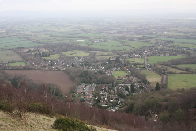
Image: © Bob Embleton Taken: 16 Jan 2011
Viewed from the south end of Pinnacle Hill. The now built up area nearest the hills is locally known as Assarts whilst the more distant built up area to the right hand side is Upper Welland. The latter was known as Lower Assart in the pre inclosure years of the 1840s. Assarting was the medieval practice of clearing the hunting forest of trees to create farm land under licence. In 1196 the Bishop of Worcester was granted a licence to extend his assart at Welland Mill. The creation of these two areas may date from as far back as then.
Images are licensed for reuse under creativecommons.org/licenses/by-sa/2.0
Image Location
Latitude
52.069515
Longitude
-2.330535