Bredbury and Romiley : Otterspool Bridge
Introduction
The photograph on this page of Bredbury and Romiley : Otterspool Bridge by Ken Bagnall as part of the Geograph project.
The Geograph project started in 2005 with the aim of publishing, organising and preserving representative images for every square kilometre of Great Britain, Ireland and the Isle of Man.

There are currently over 7.5m images from over 14,400 individuals and you can help contribute to the project by visiting https://www.geograph.org.uk
Bredbury and Romiley : Otterspool Bridge
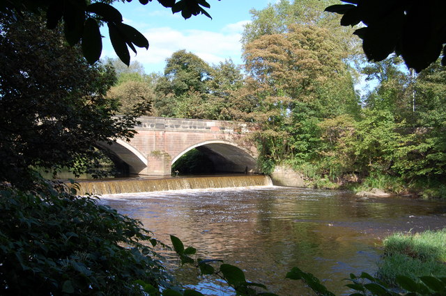
Image: © Ken Bagnall Taken: 9 Sep 2009
At the sale of the Bredbury estate in 1825, an area lying along the River Goyt was purchased by a Mr Marsden, who built a weir at Otterspool and planned to use water power to develop the valley from there to New Bridge as an industrial estate. However, he failed to secure the water rights. and by the time the lengthy legal proceedings were completed water power had been superseded by steam power.
Images are licensed for reuse under creativecommons.org/licenses/by-sa/2.0
Image Location
Latitude
53.401744
Longitude
-2.096821