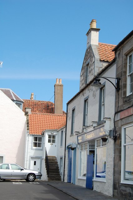
Pittenweem : High Street
Introduction
The photograph on this page of Pittenweem : High Street by Ken Bagnall as part of the Geograph project.
The Geograph project started in 2005 with the aim of publishing, organising and preserving representative images for every square kilometre of Great Britain, Ireland and the Isle of Man.
There are currently over 7.5m images from over 14,400 individuals and you can help contribute to the project by visiting https://www.geograph.org.uk

Image: © Ken Bagnall Taken: 21 Jun 2009
The white houses with red roofs illustrate the classic East Neuk building style, influenced by trade with Belgium and the Netherlands. The East Neuk offered natural trading ports for Dutch and Belgian captains as they sailed up past the east coast of England. These ships brought red pantiles as ballast and the locals soon found them to be excellent roofing material. It is just possible to make out the "crow step gable", where the gable ends rise in steps rather than the more normal smooth angled line: an architectural feature imported from the Low Countries. These and other vernacular features are common throughout Pittenweem, which has one of Scotland's best-preserved and most attractive townscapes, with many historic buildings, some restored by the National Trust for Scotland. The 'organic' layout of the town centre, which grew up piecemeal over several centuries, with numerous winding streets and alleys, is one of its particular charms. Few Scottish towns have so well preserved their ancient character.
Image Location


