Junction of Rhiwlas Street and South Street
Introduction
The photograph on this page of Junction of Rhiwlas Street and South Street by John S Turner as part of the Geograph project.
The Geograph project started in 2005 with the aim of publishing, organising and preserving representative images for every square kilometre of Great Britain, Ireland and the Isle of Man.

There are currently over 7.5m images from over 14,400 individuals and you can help contribute to the project by visiting https://www.geograph.org.uk
Junction of Rhiwlas Street and South Street
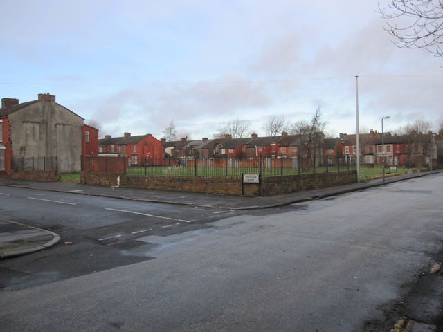
Image: © John S Turner Taken: 6 Jan 2011
Looking north across the junction of Rhiwlas Street and South Street. The cleared ground behind Rhiwlas Street was once Voelas Street, part of which still stands. The east side (right) of Rhwlas Street is due for demolition in phase 1 of the Princes Park regeneration zone project, whilst the west side (left) is part of phase 2.
Images are licensed for reuse under creativecommons.org/licenses/by-sa/2.0
Image Location
Latitude
53.388682
Longitude
-2.957752