Air Raid Shelter - RAF Peterhead
Introduction
The photograph on this page of Air Raid Shelter - RAF Peterhead by Iain Smith as part of the Geograph project.
The Geograph project started in 2005 with the aim of publishing, organising and preserving representative images for every square kilometre of Great Britain, Ireland and the Isle of Man.

There are currently over 7.5m images from over 14,400 individuals and you can help contribute to the project by visiting https://www.geograph.org.uk
Air Raid Shelter - RAF Peterhead
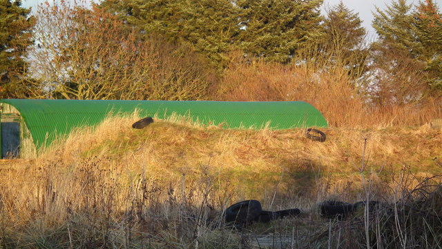
Image: © Iain Smith Taken: 11 Jan 2011
I was surprised to discover that the WW2 airfield complex between Longside and Peterhead was more extensive than I first thought. Situated some distance to the east of the airfield itself are the footings of several huts, presumably similar to the extant example in the background. The main subject of this image however, is the Stanton Air Raid Shelter, one of 4 extant at this site.
Images are licensed for reuse under creativecommons.org/licenses/by-sa/2.0
Image Location
Latitude
57.511823
Longitude
-1.837918