Railway cutting, South Brent
Introduction
The photograph on this page of Railway cutting, South Brent by Adrian Platt as part of the Geograph project.
The Geograph project started in 2005 with the aim of publishing, organising and preserving representative images for every square kilometre of Great Britain, Ireland and the Isle of Man.

There are currently over 7.5m images from over 14,400 individuals and you can help contribute to the project by visiting https://www.geograph.org.uk
Railway cutting, South Brent
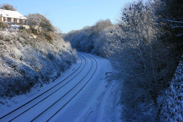
Image: © Adrian Platt Taken: 18 Dec 2010
This is the South Devon Railway mainline designed by I K Brunel. This cutting is immediately east of the former station yard. The vehicle tracks in the snow on the right of the railway lines follow the course of the Kingsbridge branchline which ran round to the right in a cutting now hidden by the trees. ironically the branchline opened after the mainline had been converted from Mr Brunel's Broad Gauge and closed when the mainline still operated. The tracks are used by Network Rail for access to the railway lines, they use the former signal box, Image occasionally as a mess-room and store when working in the area.
Images are licensed for reuse under creativecommons.org/licenses/by-sa/2.0
Image Location
Latitude
50.427449
Longitude
-3.831651