Bench mark on Princes Road
Introduction
The photograph on this page of Bench mark on Princes Road by John S Turner as part of the Geograph project.
The Geograph project started in 2005 with the aim of publishing, organising and preserving representative images for every square kilometre of Great Britain, Ireland and the Isle of Man.

There are currently over 7.5m images from over 14,400 individuals and you can help contribute to the project by visiting https://www.geograph.org.uk
Bench mark on Princes Road
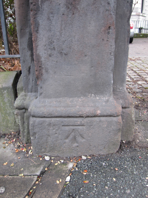
Image: © John S Turner Taken: 6 Jan 2011
This cut bench mark is on a stone post at the junction of Princes Road with Upper Hill Street. The mark is first shown on the 1891 Town Plan, and as recently as the O.S. 1959-69 map, but it is not recorded on the modern O.S. database. See also Image
Images are licensed for reuse under creativecommons.org/licenses/by-sa/2.0
Image Location
Latitude
53.394204
Longitude
-2.964041