Blackpits Chimney
Introduction
The photograph on this page of Blackpits Chimney by David Dixon as part of the Geograph project.
The Geograph project started in 2005 with the aim of publishing, organising and preserving representative images for every square kilometre of Great Britain, Ireland and the Isle of Man.

There are currently over 7.5m images from over 14,400 individuals and you can help contribute to the project by visiting https://www.geograph.org.uk
Blackpits Chimney
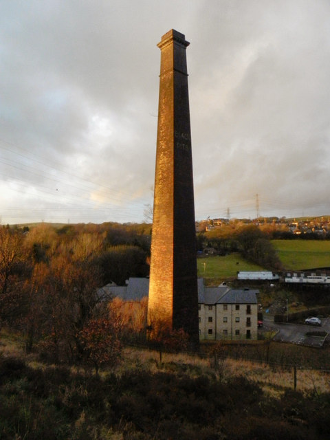
Image: © David Dixon Taken: 5 Jan 2011
The chimney, seen here from the top path between Coal Bank and Image], is all that remains of the Blackpits Cotton Spinning and Manufacturing Company. Much of the remainder of the mill site is now occupied by a modern housing development, part of which can be seen behind the chimney in this photograph.
Images are licensed for reuse under creativecommons.org/licenses/by-sa/2.0
Image Location
Latitude
53.624685
Longitude
-2.217804