
Water access hatches?
Introduction
The photograph on this page of Water access hatches? by Karl and Ali as part of the Geograph project.
The Geograph project started in 2005 with the aim of publishing, organising and preserving representative images for every square kilometre of Great Britain, Ireland and the Isle of Man.

There are currently over 7.5m images from over 14,400 individuals and you can help contribute to the project by visiting https://www.geograph.org.uk
Water access hatches?
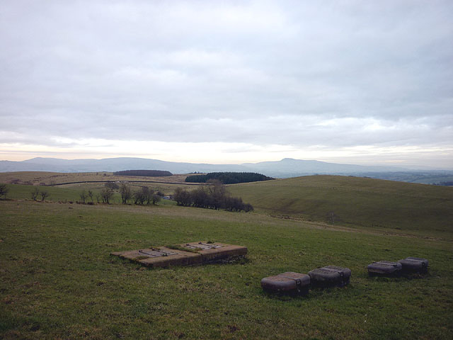
Image: © Karl and Ali Taken: 3 Jan 2011
These hatches near Havelock Woods are in line with other waterworks features nearby (syphon well in Lord's Lot Wood and characteristic iron gates with stone posts). They probably lie above the Thirlmere or Haweswater Aqueduct. Ian Taylor adds "This is on the line of the Thirlmere Aqueduct (1913 map again), which is also visible on the satellite photo. There is a valve/meter house by the road (Image) which is named "Whittington ...". I think the access road from Image to Image has something to do with water, so I presume there are local water pipes or even a reservoir too.". In the middle distance is Cragg Lot (142m), scene of a controversial wind farm application. The skyline is (from left to right) Crag Hill, Gragareth and Ingleborough.
Images are licensed for reuse under creativecommons.org/licenses/by-sa/2.0
Image Location

Latitude
54.133956
Longitude
-2.688054