Junction, Cranham
Introduction
The photograph on this page of Junction, Cranham by Derek Harper as part of the Geograph project.
The Geograph project started in 2005 with the aim of publishing, organising and preserving representative images for every square kilometre of Great Britain, Ireland and the Isle of Man.

There are currently over 7.5m images from over 14,400 individuals and you can help contribute to the project by visiting https://www.geograph.org.uk
Junction, Cranham
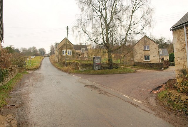
Image: © Derek Harper Taken: 31 Dec 2010
Not just any junction; this point at the eastern edge of the villages is where the telephone box and bus stop are situated. The corner of the village hall, formerly a chapel and a pottery, is on the extreme right. Up the hill past the signpost is Cranham Common.
Images are licensed for reuse under creativecommons.org/licenses/by-sa/2.0
Image Location
Latitude
51.815264
Longitude
-2.15024