Reigate Town Hall
Introduction
The photograph on this page of Reigate Town Hall by Ian Capper as part of the Geograph project.
The Geograph project started in 2005 with the aim of publishing, organising and preserving representative images for every square kilometre of Great Britain, Ireland and the Isle of Man.

There are currently over 7.5m images from over 14,400 individuals and you can help contribute to the project by visiting https://www.geograph.org.uk
Reigate Town Hall
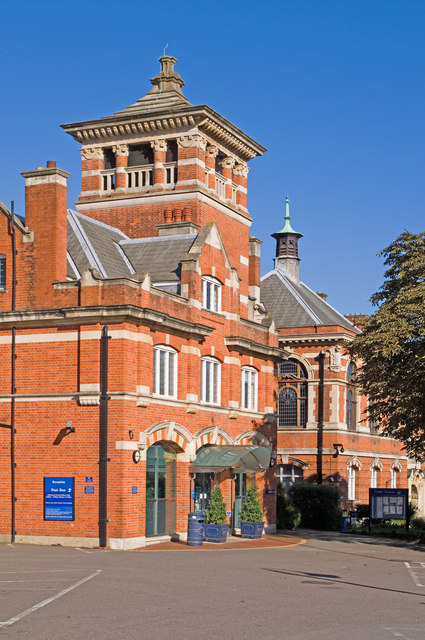
Image: © Ian Capper Taken: 25 Sep 2010
See Image for description of whole building. This section, at the southern end, was originally the Fire Station - it now houses the main entrance to the building. Beyond is the original Town Hall section of the main building, housing the old Council Chambers at first floor level.
Images are licensed for reuse under creativecommons.org/licenses/by-sa/2.0
Image Location


Leaflet Map data © OpenStreetMap
Latitude
51.239034
Longitude
-0.204985