Central Avenue, Bangor
Introduction
The photograph on this page of Central Avenue, Bangor by Rossographer as part of the Geograph project.
The Geograph project started in 2005 with the aim of publishing, organising and preserving representative images for every square kilometre of Great Britain, Ireland and the Isle of Man.

There are currently over 7.5m images from over 14,400 individuals and you can help contribute to the project by visiting https://www.geograph.org.uk
Central Avenue, Bangor
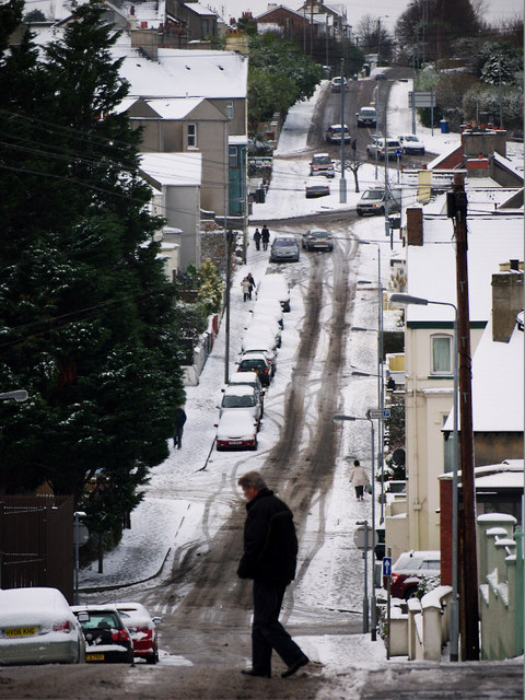
Image: © Rossographer Taken: 17 Dec 2010
Central Avenue in Bangor during the cold spell in December 2010. Around 2-3 inches fell on the town centre on the night of 16th/17th December 2010; this persisted on the ground and was topped up by a further 3-4 inches a few days later. The cold spell saw persistent sub-zero temperatures in the town and at one point the marina had partially frozen over - see Image A thaw did not set in until the 27th December. Central Avenue is a straight road leading from Main Street to Dufferin Avenue, although it dips dramatically between the two as it crosses Southwell Road. The street features on maps from 1833, although buildings were only developed after 1860. It was known as either Middle Road or Diocesan Road in the mid 19th Century. See also Image
Images are licensed for reuse under creativecommons.org/licenses/by-sa/2.0
Image Location
Latitude
54.660942
Longitude
-5.673115